
First off, if you're reading this, we're fine and have all power and necessities. Other areas of the city are facing much longer odds and need far more attention than this area.
>>>>>
>>>>>
We started in Red Hook, an industrial area on the coast of Brooklyn.

Throughout the travels, numerous trees were ripped up, but the lot near the Red Hook Ikea had a tree that was ripped up from the root, taking sidewalk and earth with it...

This small power boat arrived at it's dry dock probably due to some flooding that we'll show the effects of in a minute...


Flooding at an industrial office building at Van Brunt street near, street covered to curb, but look carefully at the dark line at the left. That is not a difference in brick color, but rather where the water level rose to. Those are large flood doors, so it's reasonable to put the water at approximately 7 feet above the curb here at high point.
Worth mentioning, the first picture shows a supermarket (Safeway) that apparently took on a large amount of water damage. Spoke with a worker and was told that the entire store was flooded and most of the food supplies ruined. Weeks before that store opens and an already underserved area of Brooklyn takes a major service hit...

When you see rainbow hues in the water, know you're in an industrial area of the city, and see flooding, you have to wonder whether or not you are looking at a future superfund site. Walking about the area was very slippery...
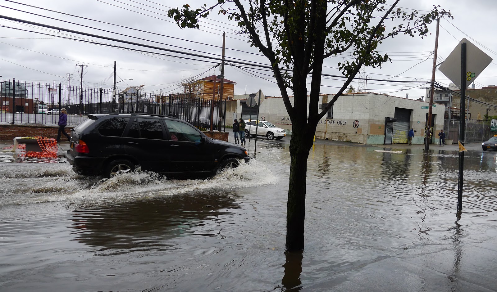
Driving in the flooded streets. Again the water level here was probably 6-9 feet above what is shown here at peak. This car would have been underwater at high tide.

Here I am in (in my trusty University of Memphis sweatshirt of course) holding my hand at the level the flood waters rose to. Out of frame on the floor above is a studio resident who holed up in his office with a few pints of good beer and rode it out in this coastal building, despite the mandatory evacuation of the Red Hook area, as it was in Area 'A' for coastal flooding.
Said he had two backup options. Panic, and further panic. Said if the water got to the second floor (while it got high, it didn't get that high), he'd jump and swim for it.
A for effort and moxie, D for staying in a dangerous area and not evacuating. This sort of thinking is what can force first responders into dangerous and potentially deadly situations.

The gentleman mentioned above says that across the bay the water rose to the level of the tracks at the earth movers. Pretty impressive.


Dark lines show the water level.


One last observation for Red Hook. Much of the city is at sea level, so water gets in basements pretty easily during normal storms. A historic hurricane? Numerous gas powered pumps were located everywhere
>>>>>
After Red Hook, the next stop was DUMBO, damage was less obvious as this is another area that is coastal already and is used to taking some water on. We parked on Front and started walking towards the water.

Well, this artist got their wish...

A larger building again using a large pump to remove the water from the basement. This will be a recurring theme throughout the city for the coming weeks. When people wonder why the MTA can't open below 34th street for the coming weeks. MTA emergency workers are doing this throughout the system.

Standing in front of the Galapagos Art Space (site of this fun presentation as part of nyc.nerdnite.com) , looking at the bridge. The entire street has some flooding left over. The photographer got a great shot of the bridge reflected in the water.

Fence along the river knocked in.

A car that took a tree to the side. First Round TKO.
>>>>>
After seeing DUMBO, our last stop before heading back to central Brooklyn was Coney Island / Brighton Beach. We drove down the Belt Parkway, which was flooded in some parts...

It was pretty spooky and lightly populated:

But the news was there, so we were hoping to see local anchors lose their hats...


While Coney Island is usually a little light in traffic after the season, this sort of damage is still telling. The last fence is not a chain link fence, but a large solid metal fence. This took a little force.

The trailers supporting construction by the Minor League A team (the Brooklyn Cyclones after the roller coaster and not the storm) have been turned, angled, and one was flipped on its side.
The news here is sand, lots of sand...

The news here is sand, lots of sand...

Burying fences...


Burying handrails...


Burying the boardwalk...

And burying the roads.

Even burying the amusement park rides off the boardwalk.
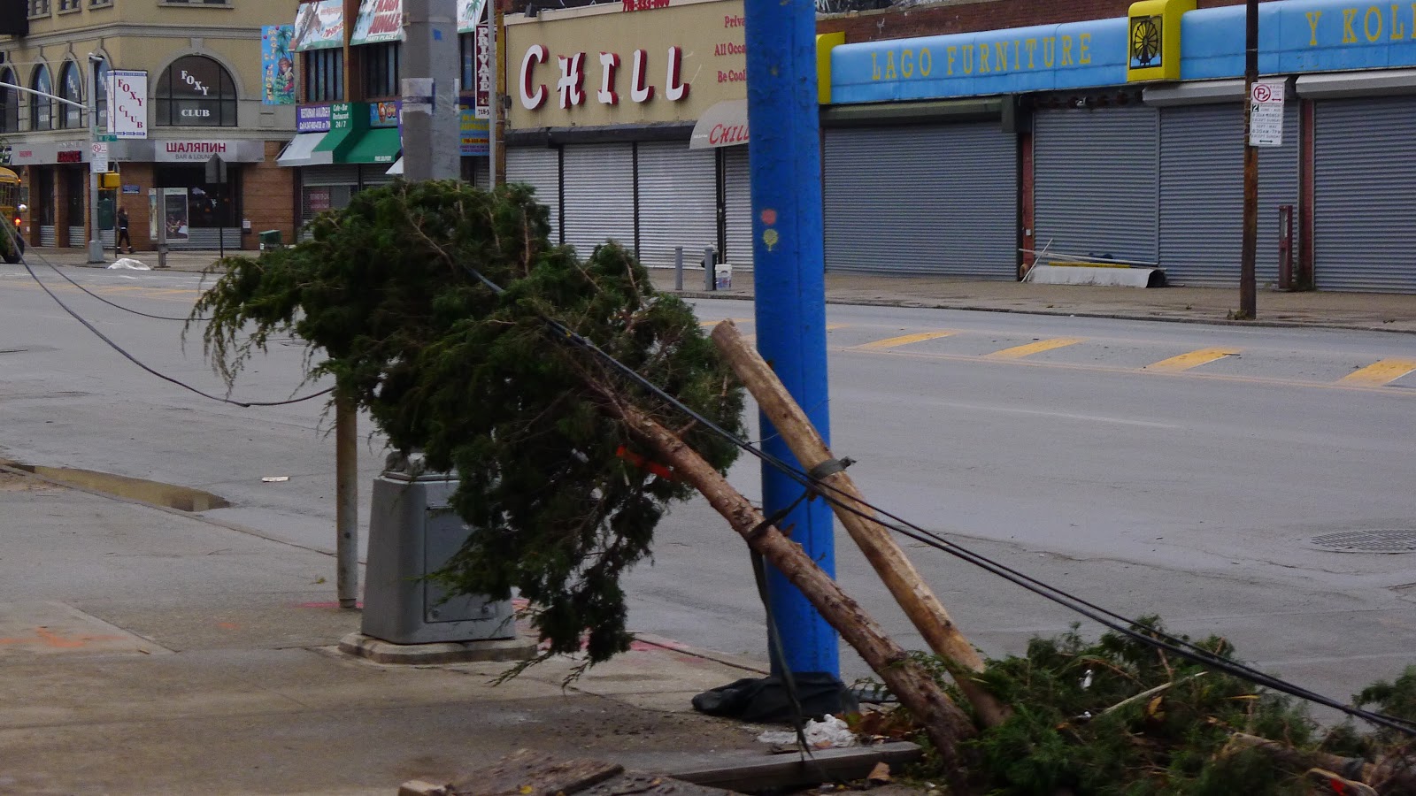
The wind damage pulled off signage...

And power...

>>>>>
With observations made, we left for home and tried to dry safely, avoiding some of the road issues.


And burying the roads.

Even burying the amusement park rides off the boardwalk.
The wind damage pulled off signage...

>>>>>
With observations made, we left for home and tried to dry safely, avoiding some of the road issues.


>>>>>
Obviously, if you've watched the news, other areas have taken a far worse beating. Long Island, parts of Queens, Manhattan under 34th, the Jersey Shore, and urban NNJ have damage tens of times worse than what is documented above. The residents of these neighborhoods are lucky that this is all we're facing and my best wishes and hopes go to those in my region facing far steeper recovery slopes.
Anyway, that's the view from here, I'll update as progress is made...
- AH
Note: Most photo credits (the better ones) by Yasmin Mistry ( idesygn.com / facebook )


